
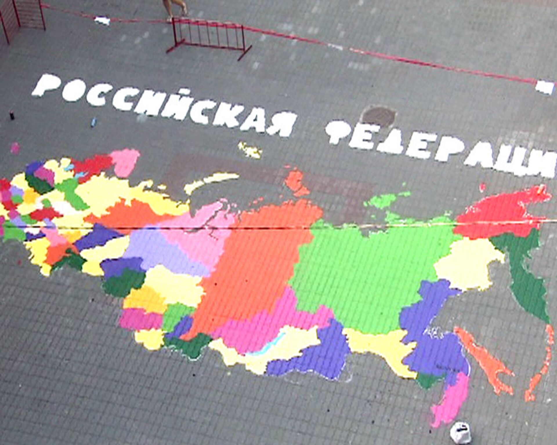
The students, who came up with the idea of drawing the map, had their professors’ active support. First, they calculated the map’s exact scale. It took undergraduate students, post-graduate students, professors and professional graffiti artists two days to draw the map, an exact replica of Russia. The students first chose a location for the map and then carefully outlined its boundaries. Then the graffiti artists took over. The map’s authors say this is the first map to show all eight federal districts, including the newly-established North Caucasus Federal District. Cartographers refer to such maps as “administrative” maps. The giant picture shows all Russia’s regions and their capitals. The best graffiti artists in Moscow worked on this cartographic masterpiece.
Scale map of Russia drawn on a Moscow street
12:36 GMT 24.06.2010 (Updated: 19:52 GMT 19.10.2022)
© RIA Novosti
Subscribe
Students and professors at the Moscow State University of Geodesy and Cartography have drawn a 100 square meter scale map of Russia on a local paved street.


